October 28th, 2025
Bird migration over the Netherlands
Mapping nocturnal bird migration to accelerate the energy transition
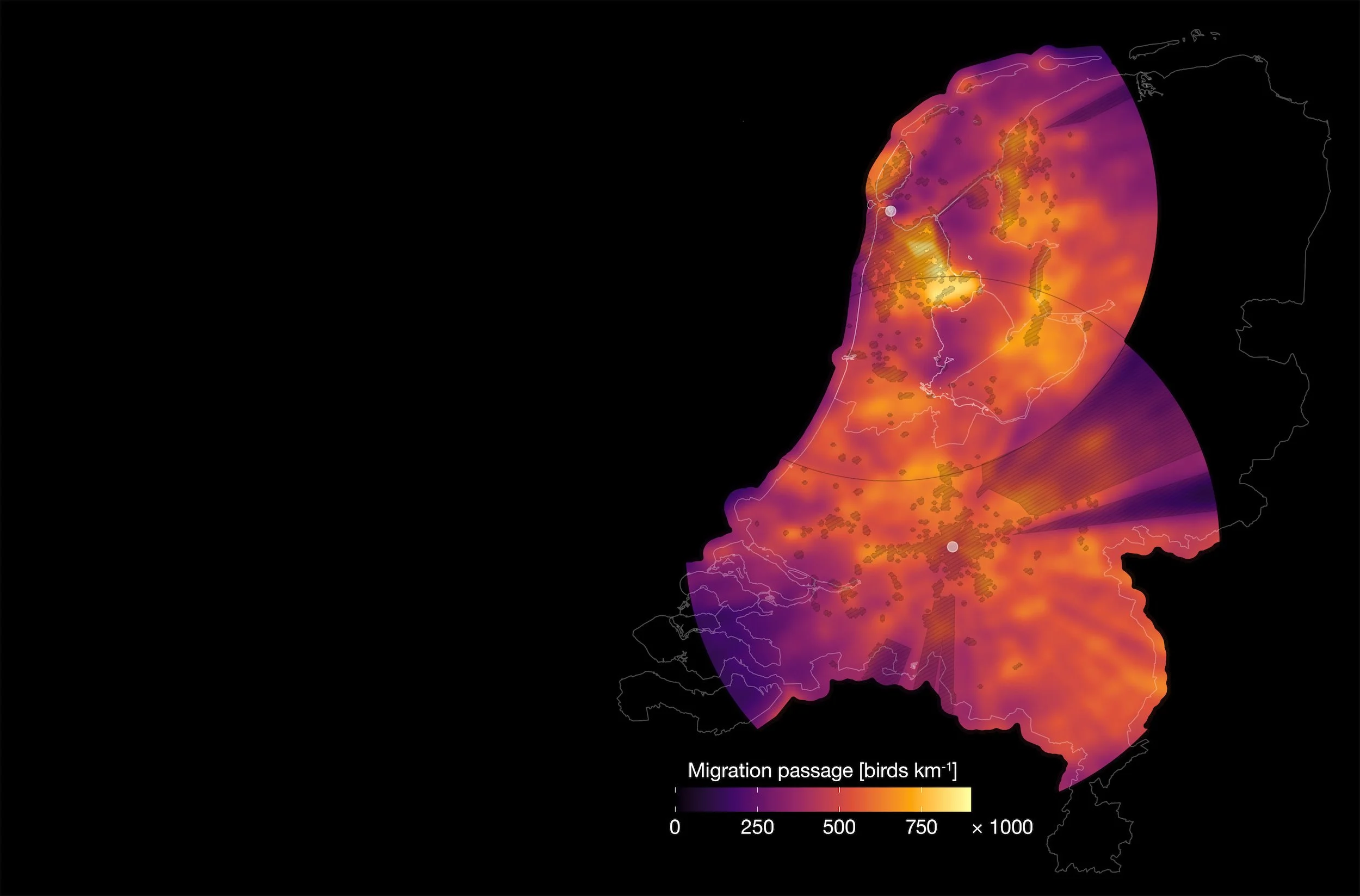
The lack of information on nocturnal bird migration complicates siting and permitting of energy infrastructure, which further slows down an already challenging energy transition. To provide this crucial information, we have developed a scalable methodology using weather radar to create large-scale maps of bird movements. This led to the development of the first nocturnal bird migration map for the Netherlands, which uncovers clear spatial trade-offs between biodiversity conservation and energy infrastructure plans. Through this method, we hope policy makers, spatial planners and developers are able to proactively avoid and reduce impacts of energy infrastructure on birds.
Large-scale mapping of nocturnal bird migration to accelerate a nature-inclusive energy transition
Bart Hoekstra, Bart Kranstauber, Maja Bradaric, Johannes De Groeve, Stacy Shinneman, Berend Wijers, Hidde Leijnse, Hans van Gasteren, Adriaan Dokter, Emiel van Loon, Judy Shamoun-Baranes
The energy transition intensifies spatial conflicts between energy infrastructure (EI) and migratory birds, fueling public resistance, litigation and permitting delays. These conflicts are often addressed only at the project level, after EI sites are chosen, leaving little room for proactive impact avoidance. We present a globally scalable method using existing weather radar infrastructure and open data to map nocturnal bird migration at high spatial resolution across large areas, demonstrating its application in the Netherlands. We find that around 50% of migration occurs at altitudes of EI. Contrary to assumed homogeneous distributions or discrete routes, our maps reveal that migration intensity varies over distances relevant for spatial planning. We demonstrate how such maps can inform selection of wind energy sites with considerable variation in migration and wind potential. Our method facilitates early-stage impact avoidance through strategic EI siting, targeted mitigation and faster permitting, offering a low-cost, scalable path toward a more nature-inclusive energy transition.
in Journal of Environmental Management — https://doi.org/10.1016/j.jenvman.2025.127753

June 21st, 2025
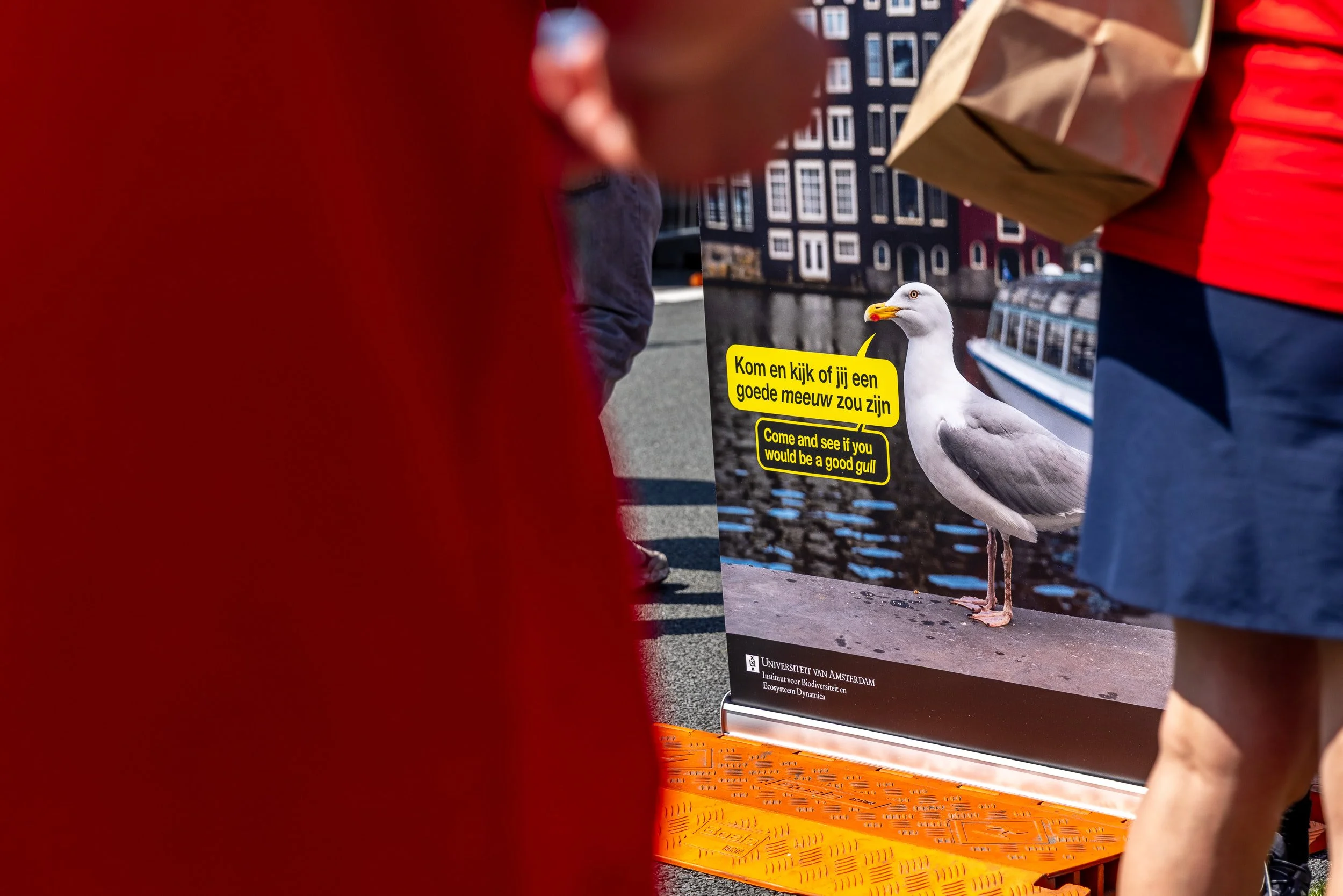
Come and see if you would be a good gull
Festival op de Ring:
“Het Grote Amsterdamse Vogel Spel”
To celebrate Amsterdam’s 750th anniversary, the city closed 15 kilometres of the ring road to car traffic on the longest day of the year, turning it into a pedestrian festival for 250,000 people.
As part of the University of Amsterdam’s participation in the City of the Future programme, we created five interactive challenges highlighting the lives of urban gulls and their ties to our city. Because connectivity and power wasn’t guaranteed, we built low-tech, hands-on activities focused on topics covering disturbance, wind parks, foraging, migration, and the species that share Amsterdam’s airspace with our gulls. I also designed posters and banners for the event.
Throughout the day we spoke with hundreds of visitors: families in the morning, and in the afternoon a lively mix of both sober and less-sober festival-goers, all enthusiastic participants (especially the latter). It was an unforgettable experience, and not only because of the sweltering 30 °C heat.
Team: Judy Shamoun-Baranes, Bart Hoekstra, Bart Kranstauber, Maja Bradaric, Stacy Shinneman, Johannes De Groeve, Berend Wijers, Nomikos Skyllas, Eldar Rakhimberdiev, Roberto Cappabianca, Shreyas Gadge, Jan Geisler

February 28th, 2025
Monitoring flying animal movements
European data on animals aloft now publicly available
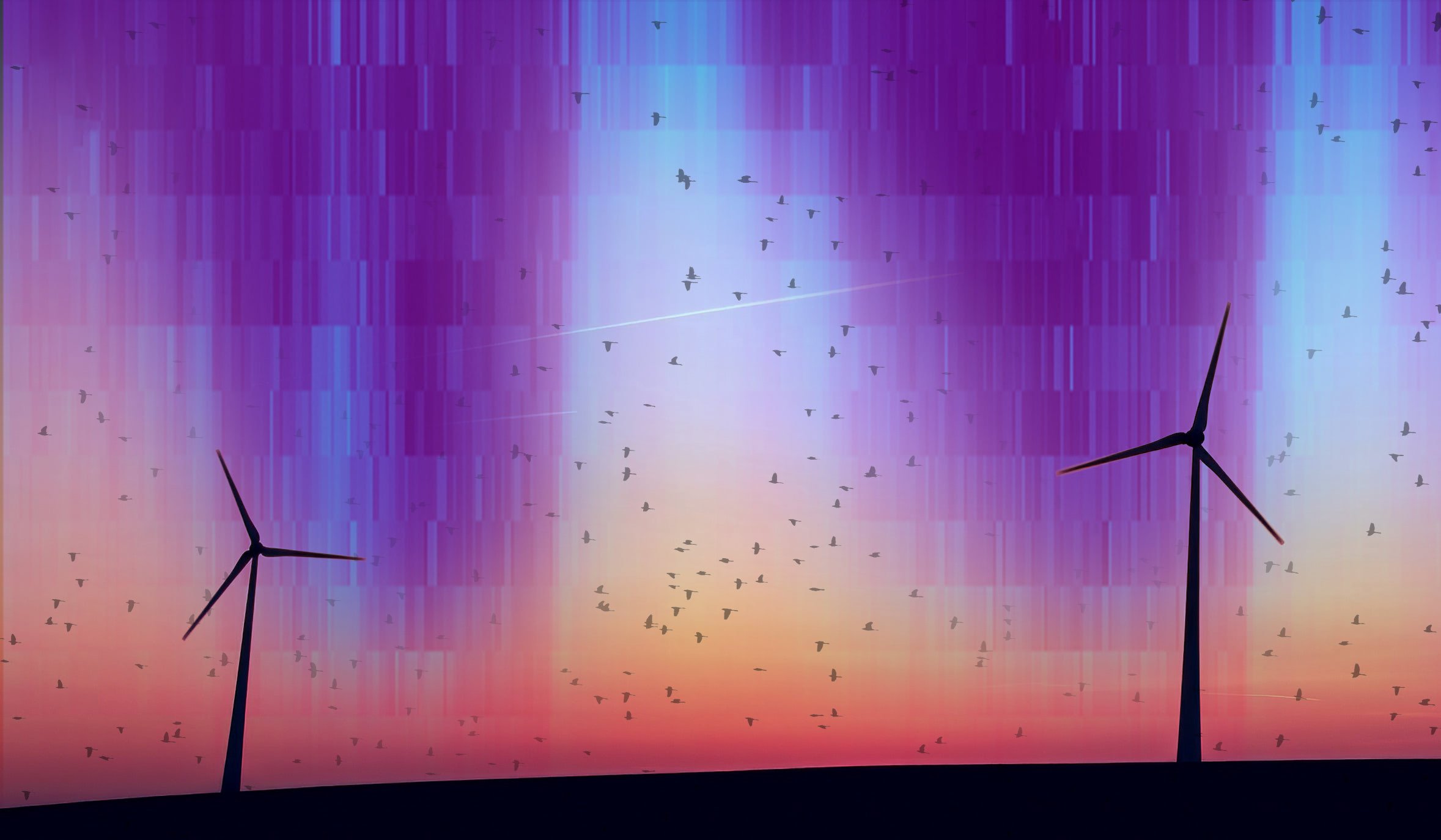
Weather radars monitor the airspace 24/7/365 and not only detect weather, but also the movements of flying animals. This makes them a tremendous resource to shed a light on the movements of animals across massive, continental, scales. Unlocking the potential of this data in Europe has always been a challenge, because of the fragmented network of 141 weather radars operated across 18 countries and their many meteorological institutes. It has been a decade-long challenge to combine the biological data and to make it available for the general community of ecologists and migration enthusiasts. Today, we proudly present the Aloft dataset — animal movement data derived from European weather radars — accessible to everyone.
Press Release at Springer Nature Research Communities – https://go.nature.com/3F0wQ0L
Biological data derived from European weather radars
Peter Desmet, Judy Shamoun-Baranes, Bart Kranstauber, Adriaan M. Dokter, Nadja Weisshaupt, Baptiste Schmid, Silke Bauer, Günther Haase, Bart Hoekstra, Pieter Huybrechts, Hidde Leijnse, Nicolas Noé, Stijn Van Hoey, Berend Wijers, Cecilia Nilsson
Weather radars detect more than weather, they also continuously register the movements of billions of animals aloft in the lower atmosphere. This makes archived, unfiltered weather radar data a goldmine for biological monitoring purposes, providing coverage of the aerial habitat in a way no other method can. Here we present two datasets of biological data extracted from European weather radar data, obtained through a collaboration with the Operational Programme for the Exchange of Weather Radar Information (OPERA) and three national meteorological services. The datasets were created by processing weather radar data with methods optimized for extracting bird targets, resulting in vertical profiles of biological targets. The datasets collectively cover 141 radar stations in 18 countries, from 2008 to 2023. Data quality and coverage differs between years, countries, and radar stations, so care must be taken when evaluating data for each specific use case. Despite these challenges the datasets are currently the most comprehensive of their kind in Europe and open new avenues in understanding continental scale movements of aerial animals.
in Scientific Data — https://doi.org/10.1038/s41597-025-04641-5

July 3rd, 2024
Making invisible bird migration visible
Mapping bird migration with weather surveillance and dedicated bird radars
For the municipalities of Amsterdam, Diemen and the province of Noord-Holland, we have mapped bird migration using a variety of radar techniques. In particular, we have addressed flight altitudes of birds and have mapped — for the first time — the aggregated spatial distribution of birds while on migration through the province of Noord-Holland. The maps we have developed can aid in the spatial planning of nature-inclusive wind energy in the region. We have made the maps available as open data with an accompanying report full of illustrations.
Self-published — http://doi.org/10.21942/uva.25983196

Dec 7th, 2023
Formidable fireworks
Millions of birds lose precious energy due to fireworks on New Year’s Eve
By combining weather radar data and bird counts, we have quantified how many birds take off immediately following fireworks, at what distance from fireworks this occurs and which species groups mainly react. We have recently published this in Frontiers in Ecology and the Environment.
Fireworks disturbance across bird communities
Bart Hoekstra, Willem Bouten, Adriaan Dokter, Hans van Gasteren, Chris van Turnhout, Bart Kranstauber, Emiel van Loon, Hidde Leijnse, Judy Shamoun-Baranes
Fireworks are important elements of celebrations globally, but little is known about their effects on wildlife. The synchronized and extraordinary use of fireworks on New Year's Eve triggers strong flight responses in birds. We used weather radar and systematic bird counts to quantify how flight responses differed across habitats and corresponding bird communities, and determined the distance-dependence of this relationship. On average, approximately 1000 times as many birds were in flight on New Year's Eve than on other nights. We found that fireworks-related disturbance decreased with distance, most strongly in the first five kilometers, but overall flight activity remained elevated tenfold at distances up to about 10 km. Communities of large-bodied species displayed a stronger response than communities of small-bodied species. Given the pervasive nature of this disturbance, the establishment of large fireworks-free zones or centralizing fireworks within urban centers could help to mitigate their effects on birds. Conservation action should prioritize avian communities with the most disturbance-prone, large-bodied bird species.
in Frontiers in Ecology and the Environment — https://doi.org/10.1002/fee.2694

August 1st, 2020
Batumi Raptor Count
From migration counts to conservation in a raptor flyway under threat
The August 2020 issue of British Birds contains a long paper on the Batumi Raptor Count. It summarises the 12-year history of BRC, provides a detailed description of a typical autumn migration season, and outlines some of our education and conservation plans for the future.
Batumi Raptor Count: From migration counts to conservation in a raptor flyway under threat
Bart Hoekstra, Johannes Jansen, Dries Engelen, Folkert de Boer, Rafa Benjumea, Jasper Wehrmann, Simon Cavaillès, Triin Kaasiku, Diego Jansen, Pia Fetting, Aki Aintila, Wouter Vansteelant
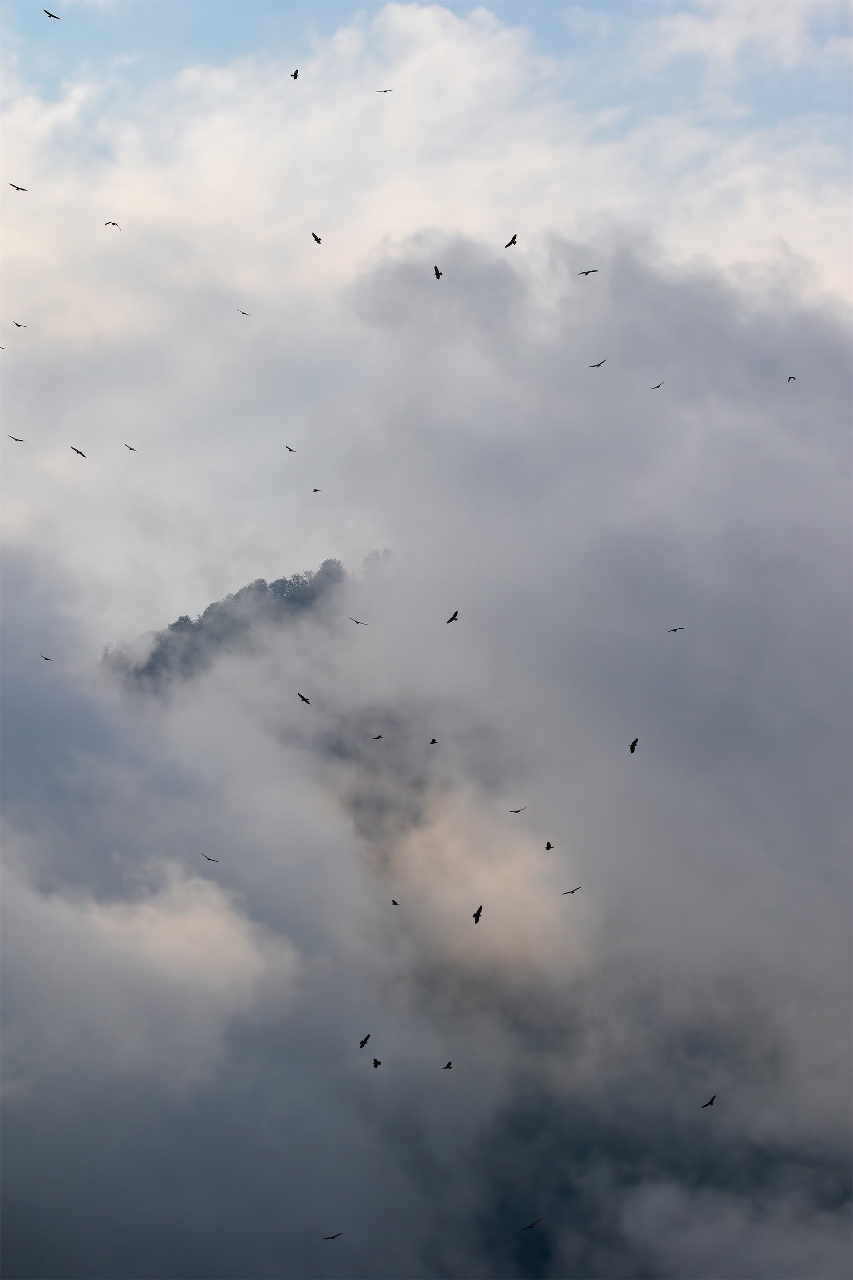
Since 2008, the Batumi Raptor Count project has monitored the autumn migration of raptors at Batumi, on the eastern shore of the Black Sea in southwest Georgia. What started as an expedition by young birders has become an invaluable project for monitoring raptor populations in the little-studied east African–Palearctic flyway. Autumn raptor migration through the Batumi bottleneck is notable for globally important concentrations of Honey-buzzards Pernis apivorus, Montagu’s Circus pygargus, Pallid C. macrourus and Marsh Harriers C. aeruginosus and accounts for at least 1% of the global breeding population of ten raptor species. By stimulating migration-based ecotourism, the project has had a significant economic impact on the communities where the count stations are located, which has increased societal and political support to reduce the widespread illegal raptor shooting in the region; it has also developed an important educational role for schoolchildren and older students. This paper summarises the 12-year history of the Batumi Raptor Count, and provides a detailed description of a typical autumn migration season. The project aims to expand its education and conservation remit while continuing to monitor one of the world’s biggest raptor migration bottlenecks.
in British Birds — https://britishbirds.co.uk/content/batumi-raptor-count


